The Kokopelli Trail
142 Miles from Fruita, CO —> Moab, UT
The Trail
The Kokopelli Trail was built in 1989 by COPMOBA, a small group of committed bikers who envisioned a single contiguous trail stretching from Colorado to Moab, Utah. It was named for Kokopelli, the magical flute player who wandered the desert and was able to drive back winter, according to Hopi legend.
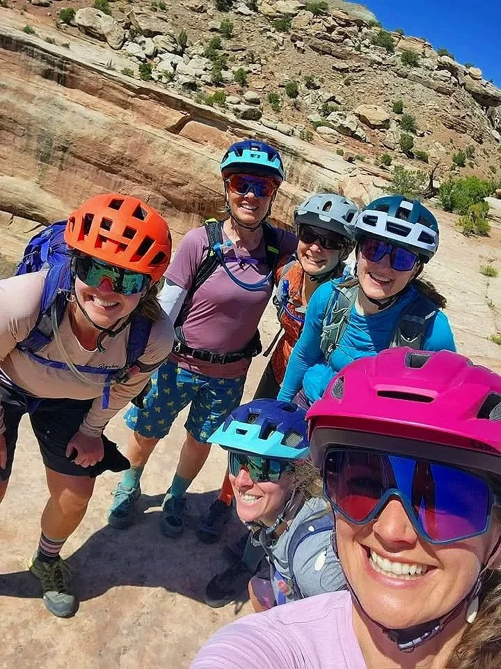
BABErpelli follows the trail in a unique, intense style that we’ve refined since 2002 for our coed sister event, Bikerpelli, and represents what we believe is the best way for an experienced biker to enjoy the entire trail in a realistic time frame. The idea is simple – we handle all the details, logistics and grunt work, and leave you free to ride for 3 days without distraction. Just show up with a bike, a tent and your toothbrush and we’ll handle the rest. Bring some friends and make it a party!
Without any additional loops, the Kokopelli Trail covers 142 miles total. The route has evolved through the years to include several additional sections of unforgettable riding, and a couple pieces which are commonly skipped for being less fun. We have all the inside info on this and our trips are built with riders’ experience in mind.
Rating the trail’s difficulty is a challenge as the terrain can vary widely from serene, meandering 2WD roads to steep rocky and technical pieces best hiked through. The trail changes with the weather; sandy conditions or a headwind can change the difficulty from one day to the next. Be prepared for varied weather, terrain, and trail conditions— this is mountain biking after all! It wouldn’t be an adventure if it were easy.
95% of the trail is completely ridable by a strong-intermediate rider with average technical skills and a solid base of endurance training.
Still, this is considered a strong-intermediate to advanced ride and is not recommended for beginners.
Water, Weather & Safety
Water: There is no potable water on the trail, so support vehicles will truck in as much as we need.
Weather: Late September is an ideal time to be on the trail. Expect daytime temps to be mid-70’s to 80’s down low, cooler as elevation increases. Nights will be cool, in the 40’s to 50’s.
Safety: This is our number one concern. While we take extensive precautions, the best risk management is prevention. Every rider is expected to have the ability to complete the trail and be self-sufficient between camps & aid stations. Opportunities to shuttle do exist if necessary.
We have the means to evacuate riders from Kokopelli but will do so only in emergencies. This is a safety net, NOT an escape from a difficult hill or flat tire.
The Terrain
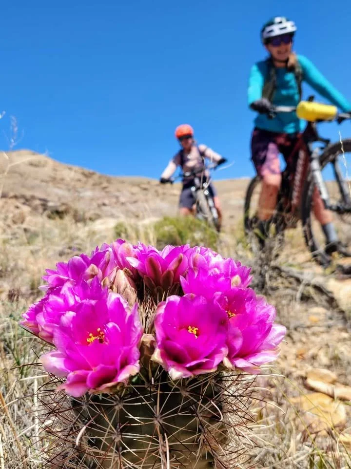
The terrain is classic Colorado Plateau and will vary frequently. Those familiar with Moab riding will feel right at home, those new to the area will encounter trail surfaces unlike anything they’ve ever seen.
Day 1 you’ll start off skirting the Colorado River, following increasingly technical single track on hard pack and occasional slick rock. Later that day, the Kokopelli climbs out of the Salt Creek area to gentle hills and rolling jeep trails past enormous entrada formations reminiscent of a moonscape from a Dr Seuss book.
Day 2 drops into the Cisco desert, a less colorful section passing a ghost town frozen in time and the historic Dewey Suspension Bridge, once the only passage across the Colorado but unfortunately now just a burnt reminder of what used to be. The rider is confronted with numerous photo ops as Kokopelli climbs through sage and juniper forests into Fisher Valley, passing through several canyons and a slickrock playground for those willing. This is a magical section with a challenging climb and descent.
Day 3 carries the riders through an extended climb into the pine and aspen forests of the La Sal mountains and over Castle Valley. From the summit, the views of nearby Moab are spectacular and it’s all downhill from here! Descend through rollercoaster-like singletrack towards Sand Flats Road and choose between the traditional casual descent past the Slickrock trail, or the fun flowy Raptor Routes or for those feeling strong, the daring descent along Porcupine Rim.
Routefinding: The entire trail is well-marked at every junction (in theory) and there is no reason why any rider should expect to lose their way so long as they follow the signs and don’t wander off trail. Still, it is essential that each rider carry a map and know how to use it. With an eye toward safety, each day starts with a pre-ride meeting where the route is detailed extensively and we have large, section maps of the trail to help the briefings. We also send out GPX files to all registered riders which include our aid stations and camps along the trail.
Difficulty
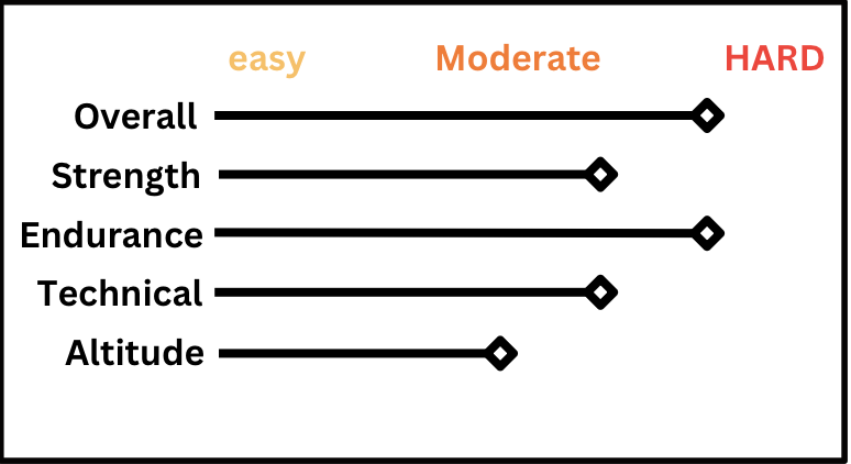
This is an estimation. Remember that every rider has different abilities and tolerances, and one rider’s 8/10 might be another rider’s 5/10. Know your ability and train for the areas you are less secure in. Our Rider Info Kit includes a training plan for those riders who would like an outline to follow before riding the Kokopelli.
Shuttles and SAG Wagon
We have optional shuttles on Days 2 and 3 to eliminate some serious elevation and make both of those days more approachable for the average rider. Details on shuttles will be in the Rider Info Kits that are sent out to registered riders.
We also have a SAG wagon, which is always an option in camps and aid stations for riders wishing/needing to skip a section of the trail. It does not follow riders on trail, and is NOT available mid-trail, so the decision to sit out a section must be made in advance. This is meant as an option to make this ride less intimidating and more accessible to a wider range of riders, but is not designed to be used by every rider at the same time (as there are 50 of you, one van just won’t fit you all!). This is also used for riders arriving too late into aid stations to complete the afternoon section of the trail before dark. The Ride Manager will keep an eye on everyone’s pace and let you know if you should probably SAG.